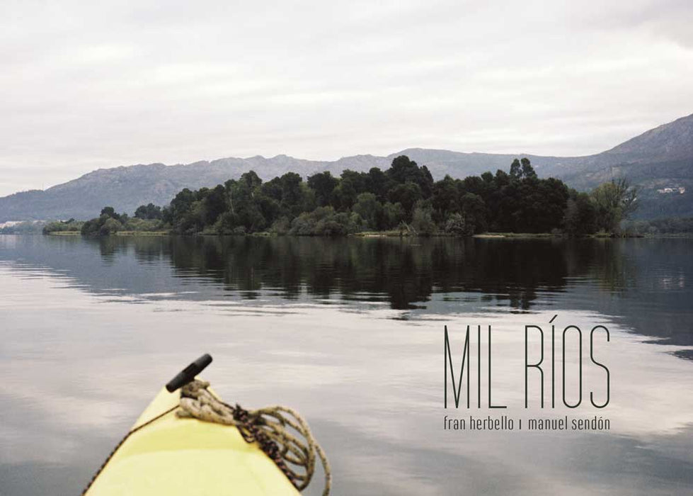
Por que reducir a paisaxe dos ríos a fotografías tiradas dende a beira? A paisaxe pode ser algo máis que unha representación visual estática.
En MIL RÍOS o importante é a experiencia do río, as fotografía son parte desa experiencia, as gráficas a súa pegada e as bitácoras, o blog e as exposicións, a súa representación.
Durante moitos anos, o coñecemento directo proporcionado polas expedicións, as viaxes ou as excursións, constituíu case o único modo de achegarse ao territorio. Este coñecemento directo deu pronto pe á creación de crónicas escritas e incluso guías e mapas. Mais, foi na época contemporánea cando, o progresivo e rápido avance da técnica provocou que esa experiencia fose substituída pola fotografía, o cine, a televisión e ultimamente por novos medios, como a internet, de tal modo que na actualidade pode dicirse que o noso coñecemento do territorio é fundamentalmente indirecto. Non podemos tocar nin sentir o que vemos.
Mesmo, cando viaxamos fisicamente a un lugar, non somos capaces –nin probabelmente queremos- desprendernos da idea previa ofrecida polo cine, a televisión ou a fotografía.
Neste proxecto pretendemos recuperar a vivencia da expedición. Decidimos percorrer os ríos, achegarnos ao descoñecido dende o que a nós nos resulta máis familiar, o mar. Subir a corrente ata onde nos sexa posíbel para así botarlle un pulso amigábel: de ti a ti. Como non facelo no “país dos mil ríos”?
Navegamos nunha piragua amarela de tres metros e medio que nos deixa o corpo amolado aos 20 minutos e que o adormece ás dúas horas, mais que tamén nos permite enfrontar a viaxe cun punto de vista moi próximo á auga, no seu mesmo plano.
Cando decidimos iniciar o proxecto só pensabamos na experiencia. Máis tarde, foi xurdindo o interese por rexistrar os percorridos e por investigar as posibilidades que se poderían derivar deses rexistros.
Empezamos por usar o GPS, un magnífico instrumento para o debuxo. Non podíamos renunciar ás posibilidades que nos ofrecen as novas tecnoloxías. Como non reparar neses trazos que lembran os primeiros debuxos da infancia?
Cando levabamos realizadas unhas cantas navegacións, sentimos a necesidade de plasmar a insólita percepción que dende o río se ten do territorio e empezamos a fotografar.
O percorrido remata configurando as súas representacións. Esta é a nosa experiencia e a nosa visión, a que agora queremos compartir con vos.
A THOUSAND RIVERS
Why should the scenery around the rivers be reduced to the photography taken from the shore? Landscapes may be something more than a visual static representation.
In A THOUSAND RIVERS the clue lies in the experience of the river itself, the photography is part of this experience, the graph is its trace, and the logbook, the blog and the exhibitions are its representation.
For many years, the direct knowledge provided by expeditions, journeys or excursions constituted the only way to approach territories. This direct knowledge brought about the creation of written chronicles, and even of guides and maps. But it was not until the contemporary era when the fast and progressive advancement of the technique made this experience to be substituted by photography, cinema, and television; and more recently by the new means, such as the internet; in such a way that, currently, it can be said that our knowledge of the environment is fundamentally indirect. We cannot touch without feeling what we see.
Even when we physically travel to a place, we are not able- or more likely we do not want to- to let go of the previous idea offered by the cinema, television or photography. Nowadays we don’t discover virgin territories, but we thoroughly research the area we are planning on visiting.
With this project we intend to recover the experience of the expedition. We decided to cover the rivers, to get close to the unknown, trough that which we find more familiar, the sea.Going up the current as far as we can possibly reach, so we can friendly defy it, being at the same level. How could we not do it in the “country of the thousand rivers”?
We sailed across the river on a three and a half metre yellow kayak which caused our bodies to sore the first twenty minutes, and to go half-asleep two hours later, but at the same time it allowed us to face the journey with a point of view very close to the water, on its same level.
When we decided to start this project we did only think about the experience. Later, the interest in recording the routes arose, as well as on investigating the possiblilities that could be derived from those records.
We started to use the GPS, a magnificent instrument for drawing. We could not reject the possiblities that the new technologies offer us. How can we not notice those traces which remind us of our first childhood drawings?
When we had carried out quite some navigation, we felt the need to capture the unusual perception which from the river we got of the territory, and we started to take photographs.
The journey ends by configuring its representations. This is our experience and our vision, the one we now want to share with you.
____
Editorial: Centro de Estudios Fotográficos
Idioma: Galego
